Search:

Franklin  Mountains  from the El  Paso  International  Airport

6.371 Miles Map- Franklin Mountains from the El Paso International Airport [+]

Franklin mountain trail parking area panorama

10.428 Miles Map- Franklin mountain trail parking area panorama [+]

Baylor Canyon Hiking Trail. Top of the trail.

42.112 Miles Map- Baylor Canyon Hiking Trail. Top of the trail. [+]

Gelato at gufo di milano #food large $5

0.062 Miles Map- Gelato at gufo di milano #food large $5 [+]

The International near San Jacinto Plaza 2018

1.483 Miles Map- The International near San Jacinto Plaza 2018 [+]

Taco Tuesdays at Farley’s $1 from 5 Pm till close #food 3499 Foothills Rd, Las Cruc

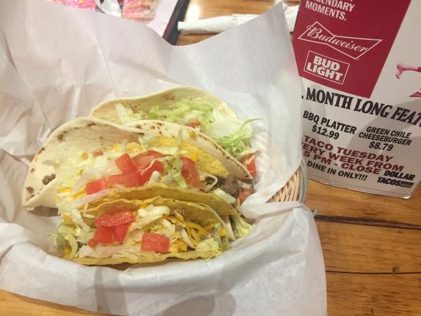
39.622 Miles Map- Taco Tuesdays at Farley’s $1 from 5 Pm till close #food 3499 Foothills Rd, Las Cruces, NM 88011 Telephone (575) 522-0466 [+]

 The  Garden and Tabla  in  El  Paso

1.49 Miles Map- The Garden and Tabla in El Paso [+]

Two paths diverge in a dessert trail. Chose the higher path.

1.512 Miles Map- Two paths diverge in a dessert trail. Chose the higher path. [+]

Au jus sandwich at Saint Clair $11 #food

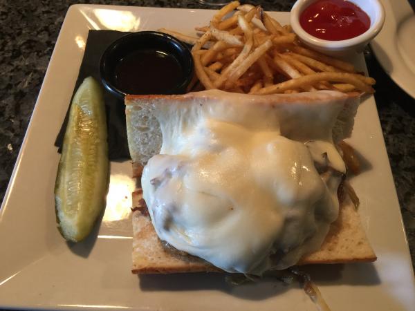
38.882 Miles Map- Au jus sandwich at Saint Clair $11 #food [+]

Palisades trail. View of downtown El Paso.

1.319 Miles Map- Palisades trail. View of downtown El Paso. [+]


Page: 1 2 3 4 5 6 7 8 9 10 11 12 13 14 15 16 17 18 19 20 21 22 23 24 25 26 27 28 29 30 31 32 33 34 35 36 37 38 39 40 41 42 43 44 45 46 47 48 49 50 51 52 53 54 55 56 57 58 59 60 61 62 63 64 65 66 67 68 69 70 71 72 73 74 75 76 77 78 79 80 81 82 83 84 85 86