37.782 Miles Map- Palisades Hiking Trail. View of El Paso and Juarez. [+]
4.444 Miles Map- OpenNote: Path to Vetrans Park. Dam on the left with a trail on top. [+]
Prior spot | Crispy flotas at Del" style="max-width:100%">
1.845 Miles Map- Prior spot | Crispy flotas at Delicias Cafe in Las Cruces [+]
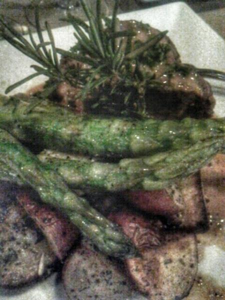
38.188 Miles Map- Steak Diane at Mesa Street Grill #food. Served with large asparagus and cut potatoes. Excellent sauce, very tender beef. The three me [+]
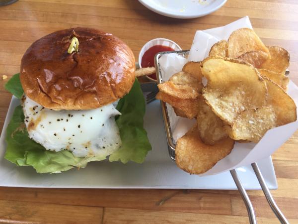
37.627 Miles Map- Block Table Tap Brunch burger with an egg #food [+]
33.339 Miles Map- Iron Horse Furnishings El Paso [+]
40.357 Miles Map- Camino Real Hotel in El Paso. A photo of the glasswork above the restaurant on the first floor. Good buffet on Sundays. [+]
38.5 Miles Map- Palisades from the top of the path. A view of El Paso and Juarez. Hiking within ten minutes of downtown, a unique city. [+]
38.188 Miles Map- The new location of Mesa Street Grill within University Hill Plaza [+]
40.248 Miles Map- Runners entrance to the ballpark in El Paso [+]
 Prior spot | Crispy flotas at Del" style="max-width:100%">